In the heart of South Australia’s famed wine region, Willunga’s rural landscape is under growing pressure from climate variability, water scarcity, and rising production costs. As local growers, viticulturists, and landholders look for ways to stay profitable while protecting the character of the region, a new generation of digital technologies is emerging to help. Rather than replacing hands-on knowledge built over generations, these tools can amplify it—turning paddocks, vineyards, and mixed farms into smarter, more resilient operations.
From precision irrigation to predictive crop modelling, modern AI tools give landowners access to insights that were once only possible for large agribusinesses. Now, even small family farms in Willunga can tap into powerful data analytics to guide planting decisions, manage water more efficiently, protect soil health, and plan long-term land use with far greater confidence. Below are some of the most impactful ways these technologies could reshape agricultural land across the Willunga basin.
1. Smarter Land-Use Planning Across Vineyards and Farms
Willunga’s patchwork of vineyards, grazing land, and mixed horticulture depends heavily on microclimate, slope, and soil type. Advanced analytics can process satellite imagery, historical weather records, and elevation data to map out the best use for each parcel of land.
- Identify cooler zones best suited to premium varieties.
- Highlight erosion-prone slopes that need groundcover or contouring.
- Flag marginal land that might be better suited for biodiversity corridors or agroforestry.
Over time, this sort of granular planning can reduce wasted inputs, improve vineyard quality, and preserve the scenic rural character that makes Willunga unique.
2. Precision Irrigation to Protect Scarce Water
Water security is a constant concern for Willunga producers. By combining soil moisture sensors, weather forecasts, and evapotranspiration models, decision systems can determine exactly when and how much to irrigate.
- Map zones within a block that need different irrigation schedules.
- Reduce water use while maintaining or improving yields.
- Prevent waterlogging and root disease linked to overwatering.
This not only helps growers meet tightening water regulations, it also protects dams, bores, and aquifers that the entire community relies on.
3. Disease and Pest Prediction Before Outbreaks Hit
Grapevine diseases, pasture pests, and fungal outbreaks can devastate a season. By analysing weather patterns, humidity, temperature, and historical incidence data, predictive systems can estimate the risk of specific diseases emerging in certain weeks or months.
- Receive early warnings for key vineyard diseases such as powdery mildew.
- Target sprays precisely where and when they’re needed.
- Reduce chemical usage and protect beneficial insects.
The result is cleaner produce, lower chemical costs, and healthier soils—crucial for a region that markets itself on quality and sustainability.
4. Yield Forecasting for Better Contracts and Cashflow
For many Willunga growers, the ability to forecast yields accurately can make or break a season. Tools that ingest historical yield data, current vine or crop health imagery, water availability, and seasonal climate outlooks can provide early estimates of harvest volume and quality.
- Negotiate better supply contracts with wineries or buyers.
- Plan labour, machinery, and storage needs well ahead of harvest.
- Make informed decisions about thinning, pruning, or fertilising.
More transparent forecasting also improves relationships with processors, as both sides can align expectations long before fruit is picked.
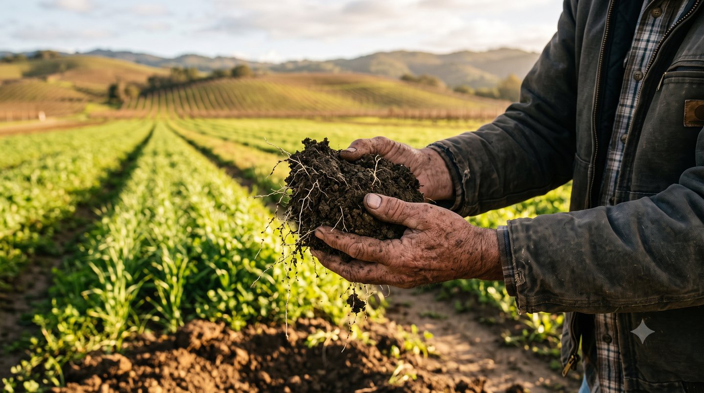
5. Soil Health Monitoring and Regenerative Practices
Long-term productivity in Willunga depends on healthy soils. Advanced models can interpret soil test data, satellite imagery, and management history to give landholders a living “health report” for every paddock or block.
- Track organic matter levels and soil carbon over time.
- Identify compaction zones that require deep ripping or controlled-traffic farming.
- Recommend cover crop mixes based on soil constraints and crop type.
When combined with regenerative practices like cover cropping, minimal tillage, and organic amendments, this data-driven approach can rebuild resilience against drought and heavy rainfall events.
6. Carbon and Biodiversity Mapping for New Revenue Streams
As carbon markets and biodiversity incentives continue to expand, Willunga landholders have an opportunity to be rewarded for good stewardship. Analytical engines can estimate carbon sequestration in soils and trees, model the impact of new plantings, and track biodiversity indicators across a property.
- Map areas most suitable for shelterbelts, native revegetation, or agroforestry.
- Quantify potential carbon credits from changed land management.
- Support applications for grants or certification programs.
This transforms environmental restoration from a cost centre into a possible income stream, aligning profitability with ecological health.
7. Optimised Machinery Use and Reduced Fuel Costs
Tractors, sprayers, and harvesters are major costs for Willunga farms. By analysing GPS data, machine logs, and paddock layouts, optimisation tools can help streamline operations.
- Design efficient driving routes to cut down on overlapping passes.
- Schedule machinery use around soil conditions to avoid compaction.
- Coordinate contractors and shared equipment between neighbouring farms.
These efficiencies reduce fuel use, machinery wear, and downtime—critical gains for smaller family operations.
8. Climate Adaptation and Long-Term Risk Planning
Willunga’s climate is shifting: hotter summers, changing rainfall patterns, and more extreme weather events are already evident. Scenario-modelling systems can simulate how different climate futures might affect crops, water, and soil on specific properties.
- Compare the performance of different grape varieties or crop types under hotter, drier conditions.
- Evaluate the value of new dams, shade trees, or netting before investing.
- Plan long-term transitions in land use to remain viable as climate zones move.
Instead of reacting season by season, Willunga’s growers can make proactive, decades-long plans for their land and enterprises.
9. Collaborative Decision-Making Across the Region
Perhaps the most powerful impact of modern analytics is their ability to bring people together. By aggregating anonymous data from multiple farms, regional stakeholders can see a bigger picture of water use, disease risk, and land-use trends across Willunga.
- Coordinate pest and disease control at a district scale.
- Support local water sharing agreements and catchment management plans.
- Inform council and regional planning decisions with real on-ground data.
This cooperative approach supports both individual farm profitability and the broader community’s long-term resilience.
Conclusion: Turning Local Knowledge into Data-Driven Advantage
Willunga’s agricultural land has been shaped by generations of practical experience, experimentation, and community cooperation. Modern analytical platforms don’t replace that wisdom; they encode and enhance it—helping growers see patterns that would be almost impossible to detect by eye or memory alone.
By embracing these tools for land-use planning, water management, soil health, climate adaptation, and regional collaboration, Willunga’s farmers and viticulturists can secure both productivity and landscape quality for decades to come. The businesses that act early will not only manage risk more effectively; they’ll also be better positioned to capture premium markets, sustainability incentives, and new revenue streams tied to environmental performance. For a region built on quality and character, combining local insight with cutting-edge analytics may be the key to a resilient and prosperous future.